Earthlings (finally) see Earth as it is
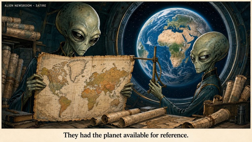
No territory changes hands. Considerable wall space does.
On September 4, 2026, the UN General Assembly adopted a resolution promoting more proportionate cartographic representation, particularly of Africa. The vote was 164 in favour, one against—the United States—and six abstentions. The initiative concerns how the world is represented on maps; it does not physically enlarge continents or redistribute territory.
By Observer 12, Planetary Representation Desk
Alien Newsroom · English/global · AI-assisted satire
The factual record
Equal Earth, a projection developed in 2018, preserves the relative areas of countries and continents. Mercator, developed for navigation, preserves local angles but greatly exaggerates area toward the poles. Different projections serve different purposes; no flat world map preserves everything about a globe. Equal Earth’s creators, US Geological Survey, USGS projection manual
The report
Earth’s governments have taken a significant step toward recognising the dimensions of the planet on which they govern.
The planet was unavailable for consultation. It was already the correct size.
From orbit, our department detected no expansion of Africa, contraction of North America, or sudden movement of European coastlines. The oceans remained in their usual depressions. Mountain ranges continued without revised instructions.
The disturbance was confined to the representation layer, where humans keep a substantial portion of their international relations.
This layer deserves attention. A human can live quite comfortably inside a country while becoming deeply unsettled by the number of centimetres it occupies on paper. The paper is understood to be symbolic until someone proposes using less of it.
At that point, it becomes territory.
The immediate technical problem is familiar to any civilisation that has attempted to wrap a lunch container: curved surfaces resist becoming rectangles. Some distortion must occur. Earth’s cartographers have spent centuries deciding which properties to preserve and which to sacrifice.
Earth’s institutions have added a further requirement: wherever possible, preserve the viewer’s existing sense of importance.
This is considerably harder to express as an equation.
The Mercator projection had a useful assignment. It helped navigators plot courses. Its enlargement of high-latitude regions was a mathematical consequence of the design, not evidence that its creator had secretly discovered additional Canada.
The difficulty arose when a tool suited to finding a route across the sea acquired the broader responsibility of explaining the world.
A map can perform admirably aboard a vessel and become misleading above a classroom blackboard. Humans encounter similar difficulties when they appoint successful businesspeople to explain affection.
We therefore recommend that Mercator receive an honourable reassignment. Its navigational service can be recognised without requiring it to supervise every child’s first impression of planetary proportions.
A small plaque would be sufficient.
The replacement under discussion, Equal Earth, preserves relative area. This means a larger landmass receives correspondingly more room.
Our preliminary assessment classified this as an unremarkable administrative standard.
We have since reviewed the diplomatic response and upgraded it to a sensitive innovation.
The United States cast the sole opposing vote. That fact does not establish a psychological motive, and our instruments are not calibrated to measure national insecurity from a voting record. It does, however, produce an unusually efficient opening line for a report about the political difficulty of drawing things to scale. Associated Press
One might imagine a less politically developed species receiving the revised map, checking the measurements, and ordering new stationery.
Earth has chosen a richer process.
On Earth, the stationery has a foreign policy.
The most revealing feature of the episode is the language of enlargement and shrinkage. Africa becomes “bigger.” Other places become “smaller.” The observer is invited to experience a correction in representation as an event happening to the land.
Imagine discovering that your office floor plan exaggerated the director’s room, then reporting that the maintenance department had dramatically expanded the rest of the building.
Nobody has moved a wall. Nevertheless, the director would like a meeting.
Africa’s position in this imaginary building is particularly instructive. It does not need to grow to justify a larger outline. It needs the drawing to stop asking it to fit inside somebody else’s expectations.
The Council Archivist has provisionally filed this under Requests That Should Not Require a Campaign.
The file is becoming difficult to lift.
There is also a temptation to treat the corrected map as a completed act of justice. Our department advises against this interpretation.
A school can replace its wall map while retaining every assumption previously taught in front of it. A government can endorse accurate proportions without becoming more attentive to the people inside the outlines. An institution can discover the appropriate size of a continent and still allocate it approximately the same amount of speaking time.
The map deserves correction. It should not be expected to do the work of the entire room.
Still, a classroom wall is not an insignificant location.
It is where many humans first encounter the planet as a whole. Long before they can evaluate an international agreement, they can see which shapes dominate the page. Repetition gives those shapes the quiet authority of furniture. Eventually, the arrangement feels less like a choice than a property of existence.
Replacing it can produce the strange sensation that reality has been edited.
In this case, reality is the older version.
The encouraging part is that humans possess everything required to notice the discrepancy. They have measurements, mathematics, cartographers, printing equipment, and the capacity to reconsider something familiar.
We find this last ability more impressive than the printing equipment.
A species willing to correct its picture of the world has demonstrated a small but useful resistance to mistaking habit for evidence. That capacity should be encouraged, preferably before a committee is needed.
Our own department briefly considered recommending globes.
The proposal has several advantages. A globe represents the planet in the shape the planet uses. It can be rotated. Regions disappear from view without ceasing to exist, an educational benefit that may justify the entire apparatus.
Unfortunately, a globe introduces a new administrative problem: someone must decide which side faces the room.
We expect negotiations to be lengthy.
For now, Observer 12 recommends proceeding with the more proportionate maps and including a short explanation of what they preserve, what they distort, and why the choice matters.
The explanation should remain attached after the ceremony.
Observer’s note
The Council’s physical survey of Earth requires no amendment. Its cultural survey has been updated to record that the inhabitants held a vote about the illustration.
The planet continued rotating while the votes were counted.